GPS Tracking & Navigation

The Garmin Instinct 3 melds rugged outdoor design with a gorgeous screen and incredible health & fitness tracking. The Instinct 3 series includ...
View full details
The COROS APEX 4 GPS Watch delivers titanium strength, dual-frequency precision, 65-hour battery, and global maps with turn-by-turn navigation. Tra...
View full details
The COROS NOMAD Outdoor GPS Adventure Watch packs free global maps, 50-hour GPS battery, wellness tracking, and rugged waterproof design into a lig...
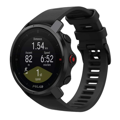
View full detailsYour next-level outdoor multisport watch with all the essential training features — the Polar Grit X Ruggedness, durability, and lightness — that...
View full detailsGarmin quatix 8 AMOLED GPS smartwatch with titanium bezel, chartplotter voice control, LED flashlight, and 16-day battery. Features marine data str...
View full detailsThe Instinct E is a supertough smartwatch available in 40 mm and 45 mm sizes. It has up to 16 days of battery life and is available in black and ch...
View full details🚨 SAVE $100 on GARMIN INREACH MESSENGER PLUS 🚨 Don't miss out! When adventure takes you to remote locations, inReach Messenger Plus is the SOS sate...
View full detailsThe COROS APEX 4 GPS Watch delivers titanium strength, dual-frequency precision, 65-hour battery, and global maps with turn-by-turn navigation. Tra...
View full detailsThe Garmin inReach Mini 3 Series delivers ultralight global satellite communication with SOS, two-way messaging, LiveTrack, weather, and full Garmi...
View full details
The Garmin Instinct Crossover AMOLED combines analog hands with a bright AMOLED display, sapphire lens, and rugged build. Features include health t...
View full detailsGarmin Instinct 3 Supernova combines rugged durability with advanced GPS, 24/7 health tracking, and Garmin Pay. Available in 45 mm or 50 mm AMOLED ...
View full detailsThis GPS navigator features an easy-to-read monochromatic display, multi-band GNSS and advanced navigation sensors to help you explore with confide...
View full detailsThis wrist-mounted GPS navigator is built for the mission and beyond. It features an easy-to-read monochromatic display, upgraded multi-band GNSS, ...
View full detailsExplore longer and more accurately with the Garmin eTrex Solar Handheld GPS. With solar-powered battery life, multi-band GPS, real-time geocaching,...
View full details


Yes! We offer Free 2-Day Shipping and Free Returns on all our products.